Need Locals Advice: Richmond to Rivers Inlet

Finished Business

Well-Known Member

Launch: 1st week of August
Duration: 7+ Days

Folks,

I have begun planning for my annual trip to Rivers Inlet. This will be my third year, with the previous two fished from a buddy's boat. We have previously trailered, ferried, trailered, and boated our way from Vancouver to Rivers Inlet, obviously boating the last leg, Hardy to the Inlet.
This year, with my own boat, and no truck to tow it, I've decided to make the trip on the water. Surprisingly, considering: ferry, towing, and parking fees, I estimate the travel costs to be roughly the same each way.

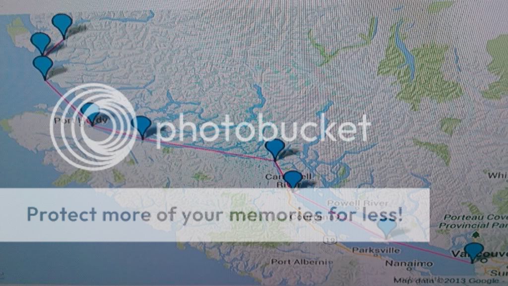
The trip is 305 Miles from dock to dock, in a direct route. I will be making two stops for fuel along the way. Here is my planned route:

Leave Richmond to Cambell River. Grab Fuel. Continue on through the Johnson Straight en route to Port McNeil. I will likely stop for fuel in Port McNeil before making the crossing over the Queen Charlotte Straight and continuing onto Rivers.

I should be able to maintain a Min cruise of 24mph, with a top cruising speed of 31mph. Given all the variables involved I expect this trip to be a minimum of 12 hours, hopefully no more than 16. (The other boat I've gone to Rivers on did it in 11hr up and 12hr home, the year before I started going).

I've heard the scenery is worth the effort to do the trip on the water. The reward of completing such a trip would be a great source of satisfaction as well.

Enough yammering...what I ask of the great members on this forum who live around the locations I will be passing through, to offer on water tips and experience of areas of concern or areas worth taking the time to view.

1) I know I will be passing through water that experiences very strong currents. This information is vital to me...what areas of this trip should I specifically try to cross during slack tides? Is it the skookumchuck narrows I will be encountering?

2) When navigating the Queen Charlotte Strait from either McNeil or Hardy to Cape Caution, which is the best route, comfort wise, to cross, given a certain direction of wind? What areas are specifically known to have nasty water?

3) For area specific info, where are good places to duck for cover if it gets real ugly? What winds make for the best travel through the straights?

As mentioned this trip is planned for early August, at a time when I hope weather is at its kindest. It would likely be done in one day but I am leaving the option open with time available to add a night or two if the following day has fairer seas.

Any info is greatly appreciate from those who live on these waters! Or any advice in general for a 300 mile boat trip. lol

Specs to note: estimates

Boat: Podded 245 Crestliner WA
Crew: Hopefully 3, maybe just myself.
Engine: 250HO 'Rude ETEC; 10hp kicker motor
Weight: 5500-6000 lbs Loaded & Fueled
Distance: 300-350 Miles
Speed: 24-31mph
MPG: 2.4 GPH: 13
Travel Time: Min 12 hours
Stops: 2 Planned
Fuel: 80 Gal Main, 23 Gal Reserve, 25 Gal portable


Cheers! I look forward to any and all info members may have for me.


Last edited by a moderator:
FB,

I know the water south of Campbell River a bit. You will not be passing through the Skookumchuck Narrows, but you will be passing through Seymour Narrows, just north of Campbell River, before you get to Browns Bay. While it is nowhere near as exciting as the Skookumchuck, I tend to try to avoid running Seymour when the tide is at full rip. Check the tide\current book and try to aim for somewhere around slack, if you can.

Your fuel capacity should not be a problem, but I see you have a stop either on the south end of Texada or Lasquiti. Neither has fuel. French Creek or Schooner Cove near Parksville would be a better bet, If you are thinking of fueling at that point.

My boat is sort of similiar to yours in that it's a 24 foot, but I've got a 190 hp i\o. Weights are close, fuel use is close. I made the trip from Campbell River to French Creek last month. On the way south, but still north of Courtenay, the wind and tides were not cooperating, raising a steep, breaking wave. I was forced down to about 15 mph for a while, until I could duck between Denman and Hornby Islands. Just sayin, don't count on being able to maintain 24 mph cruise.

Sounds like a fun trip, I've considered the run to Port Hardy, as I have some friends there. Good Luck.

RCA
 
very jealous!! If my family would let me I'd be begging for a spot...but alas...

I can speak for Seymour...been through there many times and have never considered the tides. It is not an issue in a decent powerboat. Johnson Strait seems to blow like a ***** every afternoon...may want to try and time that one for the morning or you could experience a serious butt-pounding.
 
You better watch out for stow-aways now , more then one of us on the forum would be looking for a chance to fish "the spot"


:p
 
In a boat of my size and the stats given, it should cost approx. a grand in transportation, whether on land, or over water, each way. That damn ferry would be well over $300 now for my boat w/ truck each way. The problem for crew is scheduling. It is a difficult trip to coordinate for many many reasons. We do it "on the cheap" (if that is possible in a trip of this scale) which involves sleeping on docks with limited amenities. This year I plan to rough it a little further and do as much of the trip on my boat as I can. Sleeping, eating ect. To challenge myself and do it solo is almost enough to get me to stop twisting arms lol.

I will not be taking crew applications for this trip unfortunately. Sorry guys!
 
Last edited by a moderator:
I would suggest going through Johnstone Strait around Sayward on a slack as that is what the cruise ships do. There was a worst waters scariest thread a while back that had several folks nominating this stretch. Mornings are usually better.

Have a buddy who wants to do this trip on a 30' diesel Campion. At a leisurely 7 knots there will be lots of time for the scenery.
 
You may have to change that sig line if you pull this trip off :p :cool:.

Sounds like a very doable and awesome adventure FB. Good luck buddy!!! :D.
 
Done this trip before... If you can have flexible days for wind delays.. And you end up with time do this... Head up the inside of texada, savary,, before cortes head across to heriot bay (quadra island) for fuel and travel through whiterock passage (carefully) or go around reed island and up through desolation sound.. This route is beauty!! Come out at the top end cambell river then head north.. Stop for a fish session in dennam bay flood tide at 90'.. !
 
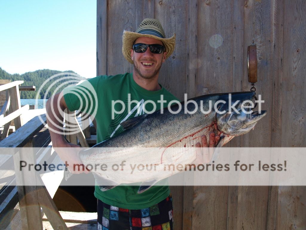
Finished Business how much did that hog in the picture weigh? just curious.., and a grand each way seems pretty dam reasonable don't think you could do a weekend there for cheaper then that. and you will be able to see all the amazing places along the way!
 
RCA Dog, Trophywife, Bows up. Thanks very much for this key information. This is ideally what I am looking for.

Jeffy, That slab was a 41 lb hatchery female. Travel costs are a considerate portion of this trip, but likely only about half. I am expecting $3-4000 on this adventure. But worth every penny.

This forum truly is great. Within 12 hours of posting my plans a member stepped forward via PM, mentioning he is making the same trip at precisely the same time. So it looks like I may have a buddy boat for the long trip!
 
Last edited by a moderator:
Having done this over a number of years on 25 to 70 feet of boat I'd suggest east side Texada ( Fuel @ Secret Cove, Pender Hbr. Westview, Lund) , up past Westview, east side Cortes, thru Gillard pass ( At close to slack) at Stewart Island, east side of East and West Thurlow island (Fuel / restraunt @ Blind channel), east side of Hardwick, down the sutherland channel out into Johnson Straights (Route cuts a considerable distance off both Georgia straight & Johnson Straights travel that can be a rough slug, plus adds very little distance and great scenery), backside of Malcolm past Port McNeil, past Port Hardy ( both have fuel), Thru Goletas Channel to south side of Hope Island, thru Shadwell Channel ( Staying on the east side of the straight on the trip up sets you up for a better crossing to Rivers, not a head swell but quartering sea for the Queen Charlottes Straight passage), and straight across the 30 miles into the mouth of Rivers. If your on a pick a very interesting overnight is on the Westside of Penrose Island ( storm bay). On the south bound trip with a westerlly tended to leave Rivers to Pine Island and run a course straight down to Blackfish Passage.( Surf the large swells almost all the way)
Definitely take a deck hand, on the various runs we've made we've had a couple of instances where without it would have seen bad consequences, clogged fuel filter in heavy fog, lower gear casing pack it up. Make sure all the gear is in top notch shape and definitely enjoy. The buddy boat works always have. And watch the fog in August, radar a must IMHO.
 
Last edited by a moderator:
Secretpursuit, well laid out plans. Following your path, you essentially take a more northern route which does look longer but far more protected. Does this more often then not save you time? It looks like an interesting route but at first glance of the map there are a few spots to look out for? Or is Gillard Pass about the only major hurdle that should be crossed at slack? Thank you for your input.
 
Plan your trip for mornings as the afternoon NW winds are not fun crossing from McNeill or Hardy to the Mainland, plan on morning pea soup fog at that time of year, so a good radar and know how to use it, crossing is easier between the top end of Malcolm Island and the airport and angle up towards the Jennetts, not as much of a swell as if you went off the top end of the Deserters. Two places to watch out for are the out going tide from Seymour Inlet (Slinglsby channel) and rounding Cape Caution. The out going tide, the couple pinicles there and the swell can make for a nice washing machine stretch of water with the odd log floating in it. If it is a flood, then don't worry too much. Cape Caution is easy if the wind is dead, if your are late in the morning to afternoon, the wind can really come up and you will be some nasty weather. I have done the trip a few times from McNeill, but usually in a 52' crew boat, but have done it a couple times in our 23' crew boat and it was not bad if you take your time. Duncanby to McNeill was around 5-5.5 hours IIRC.

I am sure David and Wade can add more as they fish and travel that country all the time.

Cheers

SS
 
Spend a lot of time boating from Powell River to Stuart island. It's a great cruise and well protected like secretpursuit said I recommend gillard pass at slack. I have been up there when a man over board was called he was not found they can be nasty. You will see boats cruising through at all time mostly guide boats but I don't do it.
As for my area the best places to get fuel are at Westview harbour and Lund. If you need a quick part great marine store at Westview harbour open Monday to Saturday.
 
Great info guys. These places sound awesome! I was google earthin' some routes and there are spots along they way that look tough to pass up! Got some more good PM's of fellas doing the same, it should make for much safer transport and one hell of a trip!
 
Very cool trip FB.. Furtherst north I have made it when cruising from Vancouver was the Octopus Islands, slowly motoring up on a friends Tollycraft. Shoal Bay is a nice spot to tie up. Bring a good camera and post pics for us!
 
FB PM sent. If you stop at Shoal Bay for a burger and beer say Hi to Mark the owner, very interesting spot. Spent a few days kick-in back watch-in the kids catch and release the pinks on the flats years ago.Hope to be back there this July after a few years absence.
 
Wanted to thank everyone for the overly helpful advice when it came to navigating this journey. The weather played nice and we were able to do the full run in one day on the way up. Flat water from Richmond to McNeil, though the 6pm crossing of the QCS got friggin' nasty!!
The way home was rougher, with Johnstone giving us a good bumping. Campbell to Van was somewhat lumpy as well. But all and all I rarely saw below 24 mph the whole trip, with about 75% at about 30mph. It was awesome!
As for the fishing, the mass of giants seemed to be late to the inlet. There was no big fish for my boat, but a buddy managed a 53 lb in the first day. We decided to mix up the fishing and get away from the main big fish spots. We did a ton of exploring/fishing and ended up logging over 1000 miles and approx 40 hours on the main engine. Didn't touch land for 10 days, it was great!
Would I do it again? Already thinking about the the next trip! lol.
So again, big thanks to those that were so helpful, both publicly and through PM. Even bigger thanks to MikeP for offering to buddy boat this trip. His experience proved very helpful in the rough stuff past Hardy, charging the lead and keeping me posted of the upcoming calmer waters. Without those updates, I would have bailed out and waited until morning. Thanks Mike! I hope Millbank rewarded you for your efforts :)

-FB-
 
Back
Top