23Hourston
Well-Known Member
Anyone running above garmin radar thinking of running with the grm 1042xsv
Most Curious about real world chart overly performance
Most Curious about real world chart overly performance
I have the Fantom and the 1242xsv. Works great. Chart overlay works good too but I find it a bit confusing sometimes and prefer to run radar seperately on my 942 or iPad. I find the colour coding on the radar blips very useful. If the blip is red it’s a danger and on possible collision course. If blue it’s not. Let’s you quickly determine which targets to watch.Anyone running above garmin radar thinking of running with the grm 1042xsv
Most Curious about real world chart overly performance
Sounds promising I understand I will need a heading sensor to make it workI have the Fantom and the 1242xsv. Works great. Chart overlay works good too but I find it a bit confusing sometimes and prefer to run radar seperately on my 942 or iPad. I find the colour coding on the radar blips very useful. If the blip is red it’s a danger and on possible collision course. If blue it’s not. Let’s you quickly determine which targets to watch.
By default the radar and plotter have a lot of features turned on. I like to turn off and simplify the screen so I can see chart and radar targets easier.
I have the B175HW thru hull. It’s a beastSounds promising I understand I will need a heading sensor to make it work
Also what transducer are you using

I have a Raymarine autopilot that was already installed and was able to use the EV1 Sensor data for my Garmin through NMEA 2000I have the 1042 and garmin fantom 18 and a smaller 722
Awesome setup. Chart overlay is good. You will need a heading sensor, garmins new gps 24xd antennae may work for that. Not sure
If you have any spedific or real world questions shoot me a dm
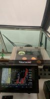
The pink blobs are the ferries. Nice feature as at a glance you know what could potentially be a danger.
View attachment 61050
Have to buy a chip. Belive its garmin bluechart g2 visionThanks for the feedback one question I’m having a problem answering is about the maps or charts. Are they built in on bought Separately if so could somebody tell me what those maps/chips are called
The phantom is pretty spendy but AwesomeI have the garmin 942xs with the fantom 18 radar. Probably one of the best setups going, I am upgrading to an 8610xsv for a little bigger screen but the chart overlay works awesome, except if you have lots of tracks in one area. I normally run chart plotter on one half and radar on the other half. The fantom will pick up pieces of wood, seagulls, heli’s, water planes, and even your own wake on super high definition I keep my turned down a little and ran around and played with it during the day for a while first. The fantom also has dual range so in heavy fog I use one zoomed in for sticks and deadheads, and one zoomed out for boats etc... and then chartplotter.
The 1042xsv is a great unit, another great radar is mid range and a bit less: the xHD which has most of the features for day to day boaters. the phantom has a couple extra things but for the average joe they don’t need all that stuff the xHD is great with the 1042xsvThe phantom is pretty spendy but Awesome
Curious why not the gms 1042 svx
Also want to ask are you just using the pre loaded mapsI have the garmin 942xs with the fantom 18 radar. Probably one of the best setups going, I am upgrading to an 8610xsv for a little bigger screen but the chart overlay works awesome, except if you have lots of tracks in one area. I normally run chart plotter on one half and radar on the other half. The fantom will pick up pieces of wood, seagulls, heli’s, water planes, and even your own wake on super high definition I keep my turned down a little and ran around and played with it during the day for a while first. The fantom also has dual range so in heavy fog I use one zoomed in for sticks and deadheads, and one zoomed out for boats etc... and then chartplotter.
Also want to ask are you just using the pre loaded maps or otherThe 1042xsv is a great unit, another great radar is mid range and a bit less: the xHD which has most of the features for day to day boaters. the phantom has a couple extra things but for the average joe they don’t need all that stuff the xHD is great with the 1042xsv
I started with the preloaded maps which are great, but put the 400 dollar chip in cause I wanted the fish eye and mariners eye 3D viewAlso want to ask are you just using the pre loaded maps
Also want to ask are you just using the pre loaded maps or other
Jesus have never even heard of the fish Eye am Mariners Eye 3-D view and I’ve been researching this thing for daysI started with the preloaded maps which are great, but put the 400 dollar chip in cause I wanted the fish eye and mariners eye 3D view
I just googled Mariners Eye 3-D viewI started with the preloaded maps which are great, but put the 400 dollar chip in cause I wanted the fish eye and mariners eye 3D view
Fish eye would be a game changer for finding hali spots. It’s almost to good to be trueYa it’s really cool, I use the fish eye 3D when setting prawn gear to make sure they don’t fall off a cliff lol I find it is totally worth it
Oh ya it would be wicked for thatFish eye would be a game changer for finding hali spots. It’s almost to good to be true