Fishing Boundries on GPS?

Islandbouy

New Member
Good Day!

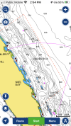
I have a lowrance elite ti2 loaded with Navionics map and am wondering if there is a way to load fishing boundries (protected areas) like Broken group islands to the GPS?
Any info woukd be greatly appreciated!

Cheers!
 
I copied the DFO FISHING area descriptions for 28 & 29 ( that’s mostly where I fish) and RCA lat/long coordinates into excel. Massaged them to get consistent looking data but ultimately uploaded the file into gpsvisualizer to see what it looked like. Did this a few times to tweak the data. Final result was to create a GPX file, copied that to my navionics micro SIM card and uploaded to my simrad chart plotters.

If the broken island protected areas are described in lat/long, and your chart plotter supports uploading tracks or routes, you should be able to do the same
 
Last edited:
Great thread. I have a 7408 garmin mfd without the navionics card. It doesn't show any fishery boundaries that I can tell, maybe it's buried in there. I have the SD card slots and update the mfd's os twice yearly. There's a second slot so if I'm understanding correctly I can add the garmin navionics and the mfd will then present map data from there and them I need to update that periodically as it appears to be a subscription?

Thanks, need all the help I can get!
 
I have all the RCA's in GPX. PM me email address.
Great thread. I have a 7408 garmin mfd without the navionics card. It doesn't show any fishery boundaries that I can tell, maybe it's buried in there. I have the SD card slots and update the mfd's os twice yearly. There's a second slot so if I'm understanding correctly I can add the garmin navionics and the mfd will then present map data from there and them I need to update that periodically as it appears to be a subscription?

Thanks, need all the help I can get!
I can’t confidently answer your question about the mfd displaying navionics map data. But it probably does. As for the map subscription, I purchased it years ago and the map data is still usable. Not as up to data as an annual renewal of course
 
I believe this picture from the Navionics app on my phone shows the RCA’s
 

Attachments

  • 48843CD6-DB73-4784-AEB1-6F95AB327B67.png
    48843CD6-DB73-4784-AEB1-6F95AB327B67.png
    349.9 KB · Views: 48
Great thread. I have a 7408 garmin mfd without the navionics card. It doesn't show any fishery boundaries that I can tell, maybe it's buried in there. I have the SD card slots and update the mfd's os twice yearly. There's a second slot so if I'm understanding correctly I can add the garmin navionics and the mfd will then present map data from there and them I need to update that periodically as it appears to be a subscription?

Thanks, need all the help I can get!
I have Garmin 1242's and 2022 maps. It does show RCA's, Sponge reefs, SRKW Zones, and fishing resticted area's. At this point I don't think it actually shows the saltwater fishing areas like 14.1, 14.2 etc. On mine you can also create custom boundaries.
Under chart settings and layers turn on restricted areas so they show up

This sounds good to me, will try it for sure thanks!
 
I have a Lowrance 542 GPS/Sounder from 2007 with a basic Navionics map card from 2003. I used the “Route Planning” under the menu to create boundaries for RCA’s and SRKW’s. Just create the waypoints for the boundary corners first, and then plot the boundary using Route Planning.
 
Back
Top