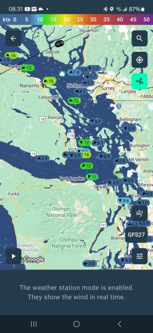
I use Windy, but stopped paying the annual fee in favor of PredictWind.com ($30+- annual fee gets more benefits, but not required).
PredictWind seems to have more weather models, and I like their "Table" page, where it will average out all the models I chose to use (at least 6 of them, or only however many I include), so I get one "average" wind-speed forecast figure for each hour, at each exact spot I'll fish!
For a good chunk of change they have a tidal CURRENT map, too, and I'll check into that. But for only one quarter of the year, as it's expensive.
Also, on this forum I just learned about Buoyweather.com (not "bouyweather)", and it looks good to see wave heights, on a map, especially. Will explore that further. I get 2 day forecast for free, but would have to pay for forecasts beyond that.
One almanac said that alot of these weather forecasts were a bit optimistic (i.e. too LOW of a wind forecast), so be careful.
South east forecasts are not as accurate as other forecasts, apparently, so be careful.
Windy.com also seems to have a topographical map, which is great.