Marley
Active Member
Hi Guys
I got caught out the other day with much stronger winds than I expected in the forecast on Windy, had to cut the trip short due to the waves.
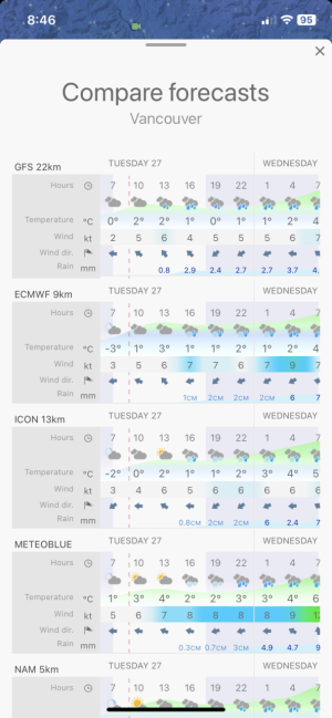
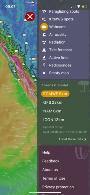
Looking closer at the app there are a bunch of different forecast models that seem to give different results. As an example I am looking at the weather tomorrow and the ECMWF model is showing snow while the NAM model is showing rain here in Vancouver. Curious as to what everyone uses as their forecast model and why.
Thanks
I got caught out the other day with much stronger winds than I expected in the forecast on Windy, had to cut the trip short due to the waves.
Looking closer at the app there are a bunch of different forecast models that seem to give different results. As an example I am looking at the weather tomorrow and the ECMWF model is showing snow while the NAM model is showing rain here in Vancouver. Curious as to what everyone uses as their forecast model and why.
Thanks