Wondering if anyone has seen or heard of Navionics sonarchart showing non existent bottom features? Starting a couple weeks back Desolation sound has sprouted a few large seamounts on my tablet:

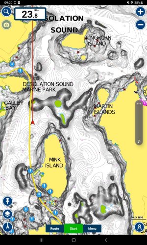
Both those clusters of "data" to the northeast and west (west is up in the screengrab) showing green drying flats are figments of someones sonar imagination. As you can see from my red vector line I transited one at 23 knots and lived to tell.
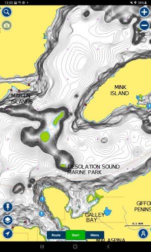
These only show when zoomed in to a certain extent; Zoomed in

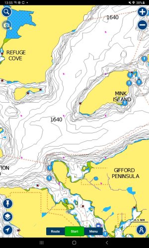
and zoomed out a bit;

After first noticing this I sent an email to Garmin but got no response. I also updated the map on my tablet figuring it might correct itself but no, they're still there. And this only occurs on my tablet, app on my phone is fine.
Anyone else have wierd things showing up on their tablet or phone apps? Anyone else showing these exact features in Desolation sound on their app?
I guess it's maybe better to be showing something thats not there and have boaters go around rather than not showing a feature but I'd rather not see anomalous features at all...

Both those clusters of "data" to the northeast and west (west is up in the screengrab) showing green drying flats are figments of someones sonar imagination. As you can see from my red vector line I transited one at 23 knots and lived to tell.
These only show when zoomed in to a certain extent; Zoomed in

and zoomed out a bit;

After first noticing this I sent an email to Garmin but got no response. I also updated the map on my tablet figuring it might correct itself but no, they're still there. And this only occurs on my tablet, app on my phone is fine.
Anyone else have wierd things showing up on their tablet or phone apps? Anyone else showing these exact features in Desolation sound on their app?
I guess it's maybe better to be showing something thats not there and have boaters go around rather than not showing a feature but I'd rather not see anomalous features at all...

