
Busterbrown
Active Member
I have had my new Garmin 1040 for a few months now and have a few questions. My unit has side-vu , downview, sounder module and is equiped with an Airmar B175 transducer and the G2 Bluechart . I am very happy with the performance on the sonars .It provides great detail in the depth of water I fish in.I am however really diSappointed with the charts that Garmin has provided.
In many areas the depth indicated on the charts is not even close to the actual depth of the water. In the photos below please notice the depth of the water on the sonar vs what the chart indicates. In the first pic the sonar reads 258ft and the chart indicates 184ft. The second photo has the sonar at183 ft and the chart 105ft I have confirmed the sonar is correct by dropping my downrigger cable to the bottom .Any one else have this issue with the charts?? I have the latest download from Garmin.Sorry for the lousy pictures but I had to take em with my phone
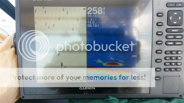
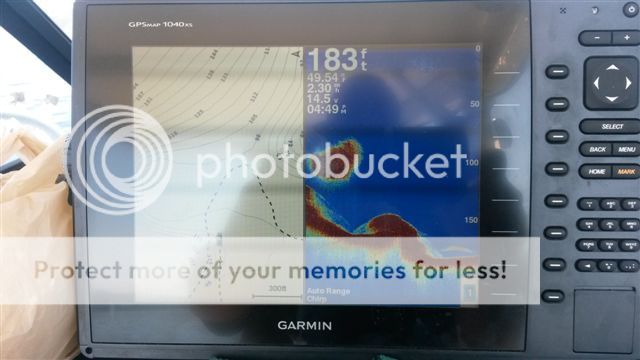
In many areas the depth indicated on the charts is not even close to the actual depth of the water. In the photos below please notice the depth of the water on the sonar vs what the chart indicates. In the first pic the sonar reads 258ft and the chart indicates 184ft. The second photo has the sonar at183 ft and the chart 105ft I have confirmed the sonar is correct by dropping my downrigger cable to the bottom .Any one else have this issue with the charts?? I have the latest download from Garmin.Sorry for the lousy pictures but I had to take em with my phone

