IronNoggin
Well-Known Member
Cameron Lake wildfire grows to 109ha, single lane alternating traffic along Hwy. 4
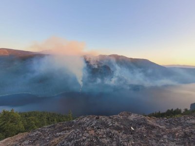
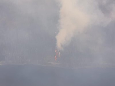
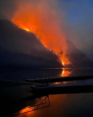
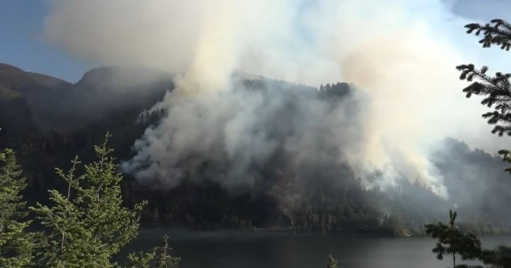
Wind has helped spur substantial growth to the Cameron Bluffs wildfire in the hills above Cameron Lake.'
Discovered Sunday, June 4, the suspected human-caused fire has grown to an estimated 109 hectares as of midday on Tuesday, June 6 with considerable smoke and flame visible.
“Crews are working on this incident and helicopters are bucketing inaccessible areas,” an update from the BC Wildfire Service read. “Airtankers and skimmers are also supporting. No structures are currently threatened.”
Fire operations forced a brief closure of Hwy. 4 near Cameron Lake late Tuesday morning, however it was re-opened after about 45 minutes. The BC Wildfire Service advises travel may be affected “intermittently”, with single lane alternating traffic established through the fire zone early Tuesday afternoon.
https://nanaimonewsnow.com/2023/06/...ely-as-cameron-lake-wildfire-reaches-roadway/
The smoke from this one in and around Port is nauseating...
Three wildfires on Vancouver Island only the beginning of what could come
Currently, there are three wildfires across the entirety of Vancouver Island.
In the northern region of the island, the Newcastle Creek fire near Sayward is finally ‘being held’ despite the fact that it’s grown from 160 to 208 hectares.
Two new wildfires crept up on Vancouver Island over the weekend. One in Nanaimo, just west of their airport which has since been extinguished, and one about six kilometres from Port Alberni in the Cameron Bluffs area.
The Cameron Bluffs blaze is presently labeled as an ‘out of control fire’, according to the BC Wildfire Service.
https://www.victoriabuzz.com/2023/0...island-only-the-beginning-of-what-could-come/