Sharphooks
Well-Known Member
Last year I spent a month on the water. Smaller boat. That had been the longest boat camping expedition of my life. I learned the key to keeping sane and enjoying oneself for that amount of time was to anti-fish. One can only fish so much. Another term for anti-fishing is pacing yourself. Focus on slowing down, hooking in to a more primordial mode of action. I’m alone on all these boat trips. No words are spoken other then maybe barking a few times at the dog when she jumps into the forepeak wet and covered with sand.
But solitude creates opportunity. Not having to talk to another human opens up windows of time to study your surroundings. The trees on shore. The rocks they cling to. Run your eyes closely over the rock formations that compose the islands you pass by. Mentally get off the water by getting up on the rocks you pass by and in so doing, manage the successful outcome of keeping your boat off the rocks.
Which brings us to Newcastle Island. I was waiting out a two day blow on the Strait of Georgia so I could cross to Texada Island and refuel at Powell River. I was stuck in Nanaimo harbor. Not a fun time. My boat was shoe-horned into a tight anchorage with a lot of other boats, each one waiting out the same blow. Harbor patrol barked at me multiple times to pull my anchor and stay out of the seaplane landing strip. Other boats with stupid and uncalled-for amounts of scope in their anchor lines resulted in multiple close calls of bumper boats as we swung into each other on tide changes in a 20 knot wind.
So to deal with that I got off the boat, left it to its own devices, and hiked Newcastle Island. I was absolutely amazed at the rock formations I saw.
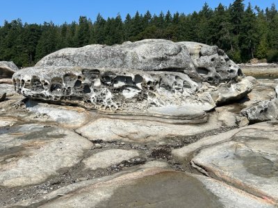
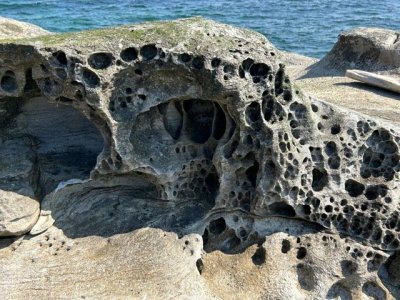
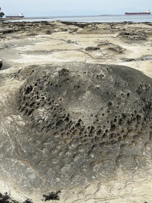
While having the luxury of an internet signal, and being able to reach out and run my fingers over these phantasmagoric rock formations that littered Newcastle Island’s beaches, I was able to investigate the geomorphology of this region of BC. I went down the rabbit hole of why Gabriola and Newcastle have sandstone, mudstone and coal layer deposits and why you’ll see granite and metamorphosed volcanic rocks more towards the mountainous spine of Vancouver Island.
And then once across the Strait of Georgia I saw huge mining activity on Texada Island....a pall of dust generated by an armada of earth moving equipment, all ripping and tearing limestone out of the side of a mountain for cement production.
Yes, a good way to keep your boat off the rocks on a long trip—- investigate them, see why they look like they do, how and why they got there, and why from island to island, they are so completely different.
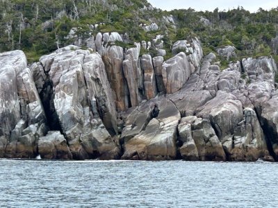
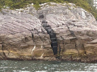
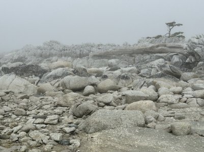
But solitude creates opportunity. Not having to talk to another human opens up windows of time to study your surroundings. The trees on shore. The rocks they cling to. Run your eyes closely over the rock formations that compose the islands you pass by. Mentally get off the water by getting up on the rocks you pass by and in so doing, manage the successful outcome of keeping your boat off the rocks.
Which brings us to Newcastle Island. I was waiting out a two day blow on the Strait of Georgia so I could cross to Texada Island and refuel at Powell River. I was stuck in Nanaimo harbor. Not a fun time. My boat was shoe-horned into a tight anchorage with a lot of other boats, each one waiting out the same blow. Harbor patrol barked at me multiple times to pull my anchor and stay out of the seaplane landing strip. Other boats with stupid and uncalled-for amounts of scope in their anchor lines resulted in multiple close calls of bumper boats as we swung into each other on tide changes in a 20 knot wind.
So to deal with that I got off the boat, left it to its own devices, and hiked Newcastle Island. I was absolutely amazed at the rock formations I saw.


While having the luxury of an internet signal, and being able to reach out and run my fingers over these phantasmagoric rock formations that littered Newcastle Island’s beaches, I was able to investigate the geomorphology of this region of BC. I went down the rabbit hole of why Gabriola and Newcastle have sandstone, mudstone and coal layer deposits and why you’ll see granite and metamorphosed volcanic rocks more towards the mountainous spine of Vancouver Island.
And then once across the Strait of Georgia I saw huge mining activity on Texada Island....a pall of dust generated by an armada of earth moving equipment, all ripping and tearing limestone out of the side of a mountain for cement production.
Yes, a good way to keep your boat off the rocks on a long trip—- investigate them, see why they look like they do, how and why they got there, and why from island to island, they are so completely different.


Last edited:

