Insight Genesis...anyone using it?

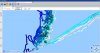
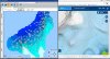
Just purchased a new chart plotter (Simrad NSS8) for the boat and I was looking at all the features that modern chart plotters are capable of. I stumbled on a video showing how you can record sonar data to create your own high detail charts for the areas you fish. Does anyone have any experience with this and if so what are your thoughts? I had to sign up to see if there was much in my local area for shared charts and there doesn't seem to be a whole lot. Either people are keeping these data for personal use and not sharing or there's just not a lot of people using it. Seems like it would be a valuable tool for areas you fish. Thoughts?

https://insightstore.navico.com/insightgenesis
 
i use it mainly in fresh water works great to find humps rock piles reefs drop-offs ect. record your trip, upload, create map, download to sounder next time you fish the area you have a detailed map of the area showing the exact shape of the bottom so you can troll right up to reefs humps ect and present your gear extremely close to structure without losing gear to unexpected bottom changes that don't show up on regular marine charts or lake maps .if you like to troll close to bottom or tight to shore it is awesome for that.
 
i keep all my charts private that way all the hidden areas i find are not public knowledge and will not receive fishing pressure .also you can cover a lot of water in a days fishing so you can make maps of large areas quite quickly
 
I've played with it abit. If you are going to fish a new spot and there was a community map for it. That would be helpful. It is the best map avail as you are charting the actual bottom and not relying on an old raster map that's been converted to digi.
http://www.sportfishingbc.com/forum/showthread.php?30803-HDS-insite-mapping
This is a screen shot of Ferrer point layered onto a google earth

I thought I would bring this thread back to life to see if others have used this software and get an update on it. Is it worth the effort? Are there community maps for some of our local fishing spots? For those that don't know what this is about here is a video.


and a link to the software community
https://gofreemarine.com/insight-genesis/
 
have you tried it out yet GLG?

i use it all the time, this year i have about 12,000 acres. Sandheads, Tunsall, thrasher. i even purchased insight planner to back up and add RCA's , sponge closures, routeCapture.JPG s, etc
 
it would be amazing to have 10-20 boats all uploading say thrasher on one weekend. then it would be nearly done


this is navionics and insight nearly side by side. there alittle off but
 

Attachments

  • Capture3.JPG
    Capture3.JPG
    326.2 KB · Views: 52
you can upload to navionics website as well...... sonar charts. you use the export feature on your unit and upload to sonarcharts. But only as a gpx file i think
 
  • Like
Reactions: GLG
Thanks for the pics Bones. I have not tried it yet but I suspect I will be giving it a try this spring. The amount of times I fish at Kitty Coleman hump should make for a decent chart. Plus I know a few other anglers that might what to get in on the results of mapping that area.
 
To help with processing. Keep your file size small. Record several trips through the day. On a day of fishing I will have 4-8 files. This will help the folks at gofree process the files easier
 
  • Like
Reactions: GLG
one of the problems I noted was correcting for the tides. Unless you keep the record time short and constantly update your offset using a tide graph. Anyone else have that trouble - and/or have another suggestion?
 
Back
Top