
You are using an out of date browser. It may not display this or other websites correctly.
You should upgrade or use an alternative browser.
You should upgrade or use an alternative browser.
New Central Coast Crab Closures
- Thread starter Hardy Guy
- Start date
Howzer
Active Member
Two years ago the commercial crabbers on the north and central coasts were saying it was the best year ever and record numbers were shipped to China.
But all we were getting were under-sized. Blunden used to be amazing crabbing, couldn't find a keeper last year what with the commercial guys and the sea otters...
But all we were getting were under-sized. Blunden used to be amazing crabbing, couldn't find a keeper last year what with the commercial guys and the sea otters...
New fishing closures proposed for crab | CCIRA
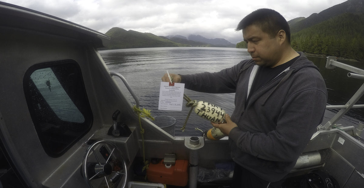
The two key findings from our published research papers are: (1) our catches have declined such that we cannot meet our FSC needs, and (2) fishing closures can help crab populations recover.
There is a link to a news release
ishery Notice
Category(s):RECREATIONAL - Shellfish
Subject:
FN0319-RECREATIONAL - Shellfish - Crab - Central Coast - Areas 6 to 9 - April 1, 2021 - Implementation of Central Coast Crab Closures
Effective April 1, 2021 at 00:00:01 hours until further notice, Recreational Crab fishing is closed as outlined below:
Mussel Inlet,
That portion of Subarea 7-7 lying Easterly of a line that begins at 52°54.608550'N 128°7.088569'W [Carse Point] then South to 52°53.891016'N 128°6.686082'W [East of David Bay].
Khutze Inlet,
That portion of Subarea 6-23 lying Southerly of a line that begins at 53°05.7887'N 128°27.1974'W [Pardoe Point] then to due East to 53°05.7865'N 128°25.7469'W.
Kynoch Inlet,
That portion of Subarea 7-11 that is East of a line starting on the South shore at 52°44.5728'N 127°57.9885'W due North to a point at 52°45.0973'N 127°57.9743'W. This closure includes the Eastern portion of Kynoch Inlet and Culpepper Lagoon.
Higgins Passage,
That portion of Subareas 6-16 and 7-3 lying inside of a line that begins at 52°29.074586'N 128°45.836113'W [SouthWest Swindle Island], then SouthWest to 52°28.658625'N 128°47.783029'W, then South to 52°27.752182'N 128°47.957771'W, then East to 52°27.505255'N 128°45.896523'W [West Price Island], then following the Northern shoreline of Price Island to 52°27.564212'N 128°37.583357'W, then 52°27.919086'N 128°36.925324'W then following the Southern shoreline of Swindle Island to the beginning point.
Griffin Passage,
That portion of Subarea 7-9 inside a line that begins at 52°46.0240'N 128°20.9051'W, then due East to 52°46.0175'N 128°19.9661'W then following the Eastern shoreline to the South to the point 52°40.5787'N 128°16.3566'W and then due West to 52°40.5787'N 128°17.2617'W and then following the West shore North to the beginning point.
Bottleneck Inlet,
That portion of Subarea 7-6 within Bottleneck Inlet: Defined by those waters inside a line that begins at 52°42.7'N 128°25.5'W, then to 52°42.8'N 128°25.5'W, then following the shoreline back to the beginning point.
Troup Passage,
That portion of Subarea 7-15 lying inside of a line that begins at 52°18.2012N 127°57.9682W [Jagers Point], then following the Westerly shoreline of Cunningham Island to 52°12.2522N 128°05.7182W [Dumas Point], then to 52°13.5952N 128°07.3982W [Chatfield Island], then following the Northerly shoreline of Chatfield Island to 52°18.2012N 128°00.8312W, then due East to the beginning point.
Lama Passage,
That portion of Subarea 7-17 (Hauyet): Those waters of Lama Passage and adjacent waters inside a line that begins at 52°4.2'N 128°5.6'W (Westminster Point), then to 52°3.9'N 128°3.0'W (Harbourmaster Point), then following the Southern shoreline to the beginning point.
Koeye Inlet,
That portion of Subarea 8-3 that is East of a line starting Koeye Point due North to the shoreline. This closes Koeye River estuary.
Rivers Inlet,
Subareas 9-5 to 9-9
Johnston Bay,
That portion of Subarea 9-3 (Johnston Bay): Those waters of Rivers Inlet inside a line that begins at 51°30.4'N 127°32.2'W, then to 51°30.5'N 127°31.5'W, following the Southerly shoreline back to the beginning point.
South Bentinck 1,
That portion of Subarea 8-12 within the South end of Bentinck arm: South of a line that begins at 52°03.4381'N 126°41.3674'W, then to 52°02.6243'N 126°43.1459'W.
South Bentinck 2,
That portion of Subarea 8-12 within Bentinck Arm inside a line that begins at 52°08.3851'N 126°49.8189'W, then due North to 52°09.9041'N 126°49.7904'W then following the Eastern shoreline to the South to the point 52°03.4381'N 126°41.3674'W and then due West to 52°02.6243'N 126°43.1459'W and then following the West shore North to the beginning point.
Dean Channel,
That portion of Subarea 8-8 within the North end of Dean Channel: North of a line that begins at 52°35.3013'N 127°09.7818'W, then to 52°34.4591'N 127°08.9307'W and subarea 8-9.
Kwatna Bay,
That portion of Subarea 8-14 within Kwatna Bay: East of a line that begins at 52°07.0781'N 127°26.0781'W, then to 52°06.4534'N 127°26.0781'W.
Quatlena River Estuary,
That portion of Subarea 8-14 within Kwatna Inlet: South of a line that begins at 52°03.5732'N 127°36.0804'W, then to 52°03.3190'N 127°34.8727'W.
Variation Order Number: 2021-137, 2021-138 and 2021-139
Notes:
Possession limits are two times the daily limits.
Barbless hooks are required when fishing for salmon in tidal waters of British Columbia.
The term "marked" means a hatchery fish that has a healed scar in place of the adipose fin.
Sport anglers are encouraged to participate in the Salmon Sport Head Recovery program by labelling and submitting heads from adipose fin-clipped Chinook and Coho Salmon. Recovery of coded-wire tags provides critical information for coast-wide stock assessment.
Contact the Salmon Sport Head Recovery Program toll free at (866) 483-9994 for further information.
Anglers are advised to check http://bcsportfishguide.ca for fishing closures and other recreational fishing information.
Tidal Water Sport Fishing Licences can be purchased via any computer connected to the internet at https://www-ops2.pac.dfo-mpo.gc.ca/nrls-sndpp/index-eng.cfm or by using Google search key words "Recfish Licence".
Did you witness suspicious fishing activity or a violation? If so, please call the Fisheries and Ocean Canada 24-hour toll free Observe, Record, Report line at (800) 465-4336.
For the 24 hour recorded opening and closure line, call toll free at
1-(866)431-FISH (3474).
FOR MORE INFORMATION:
Darren Chow
North Coast Recreational Fisheries Manager
Fisheries & Oceans Canada
417 - 2nd Ave West, Prince Rupert, BC, V8J 1G8
250 627-3441
Fisheries & Oceans Operations Center - FN0319
Sent March 24, 2021 at 1349
fish brain
Crew Member
It's hard to believe that the Rec fishers put that much pressure on the resource up that way. This is NOT good news for everone in all areas.ishery Notice
Category(s):
RECREATIONAL - Shellfish
Subject:
FN0319-RECREATIONAL - Shellfish - Crab - Central Coast - Areas 6 to 9 - April 1, 2021 - Implementation of Central Coast Crab Closures
Effective April 1, 2021 at 00:00:01 hours until further notice, Recreational Crab fishing is closed as outlined below:
Mussel Inlet,
That portion of Subarea 7-7 lying Easterly of a line that begins at 52°54.608550'N 128°7.088569'W [Carse Point] then South to 52°53.891016'N 128°6.686082'W [East of David Bay].
Khutze Inlet,
That portion of Subarea 6-23 lying Southerly of a line that begins at 53°05.7887'N 128°27.1974'W [Pardoe Point] then to due East to 53°05.7865'N 128°25.7469'W.
Kynoch Inlet,
That portion of Subarea 7-11 that is East of a line starting on the South shore at 52°44.5728'N 127°57.9885'W due North to a point at 52°45.0973'N 127°57.9743'W. This closure includes the Eastern portion of Kynoch Inlet and Culpepper Lagoon.
Higgins Passage,
That portion of Subareas 6-16 and 7-3 lying inside of a line that begins at 52°29.074586'N 128°45.836113'W [SouthWest Swindle Island], then SouthWest to 52°28.658625'N 128°47.783029'W, then South to 52°27.752182'N 128°47.957771'W, then East to 52°27.505255'N 128°45.896523'W [West Price Island], then following the Northern shoreline of Price Island to 52°27.564212'N 128°37.583357'W, then 52°27.919086'N 128°36.925324'W then following the Southern shoreline of Swindle Island to the beginning point.
Griffin Passage,
That portion of Subarea 7-9 inside a line that begins at 52°46.0240'N 128°20.9051'W, then due East to 52°46.0175'N 128°19.9661'W then following the Eastern shoreline to the South to the point 52°40.5787'N 128°16.3566'W and then due West to 52°40.5787'N 128°17.2617'W and then following the West shore North to the beginning point.
Bottleneck Inlet,
That portion of Subarea 7-6 within Bottleneck Inlet: Defined by those waters inside a line that begins at 52°42.7'N 128°25.5'W, then to 52°42.8'N 128°25.5'W, then following the shoreline back to the beginning point.
Troup Passage,
That portion of Subarea 7-15 lying inside of a line that begins at 52°18.2012N 127°57.9682W [Jagers Point], then following the Westerly shoreline of Cunningham Island to 52°12.2522N 128°05.7182W [Dumas Point], then to 52°13.5952N 128°07.3982W [Chatfield Island], then following the Northerly shoreline of Chatfield Island to 52°18.2012N 128°00.8312W, then due East to the beginning point.
Lama Passage,
That portion of Subarea 7-17 (Hauyet): Those waters of Lama Passage and adjacent waters inside a line that begins at 52°4.2'N 128°5.6'W (Westminster Point), then to 52°3.9'N 128°3.0'W (Harbourmaster Point), then following the Southern shoreline to the beginning point.
Koeye Inlet,
That portion of Subarea 8-3 that is East of a line starting Koeye Point due North to the shoreline. This closes Koeye River estuary.
Rivers Inlet,
Subareas 9-5 to 9-9
Johnston Bay,
That portion of Subarea 9-3 (Johnston Bay): Those waters of Rivers Inlet inside a line that begins at 51°30.4'N 127°32.2'W, then to 51°30.5'N 127°31.5'W, following the Southerly shoreline back to the beginning point.
South Bentinck 1,
That portion of Subarea 8-12 within the South end of Bentinck arm: South of a line that begins at 52°03.4381'N 126°41.3674'W, then to 52°02.6243'N 126°43.1459'W.
South Bentinck 2,
That portion of Subarea 8-12 within Bentinck Arm inside a line that begins at 52°08.3851'N 126°49.8189'W, then due North to 52°09.9041'N 126°49.7904'W then following the Eastern shoreline to the South to the point 52°03.4381'N 126°41.3674'W and then due West to 52°02.6243'N 126°43.1459'W and then following the West shore North to the beginning point.
Dean Channel,
That portion of Subarea 8-8 within the North end of Dean Channel: North of a line that begins at 52°35.3013'N 127°09.7818'W, then to 52°34.4591'N 127°08.9307'W and subarea 8-9.
Kwatna Bay,
That portion of Subarea 8-14 within Kwatna Bay: East of a line that begins at 52°07.0781'N 127°26.0781'W, then to 52°06.4534'N 127°26.0781'W.
Quatlena River Estuary,
That portion of Subarea 8-14 within Kwatna Inlet: South of a line that begins at 52°03.5732'N 127°36.0804'W, then to 52°03.3190'N 127°34.8727'W.
Variation Order Number: 2021-137, 2021-138 and 2021-139
Notes:
Possession limits are two times the daily limits.
Barbless hooks are required when fishing for salmon in tidal waters of British Columbia.
The term "marked" means a hatchery fish that has a healed scar in place of the adipose fin.
Sport anglers are encouraged to participate in the Salmon Sport Head Recovery program by labelling and submitting heads from adipose fin-clipped Chinook and Coho Salmon. Recovery of coded-wire tags provides critical information for coast-wide stock assessment.
Contact the Salmon Sport Head Recovery Program toll free at (866) 483-9994 for further information.
Anglers are advised to check http://bcsportfishguide.ca for fishing closures and other recreational fishing information.
Tidal Water Sport Fishing Licences can be purchased via any computer connected to the internet at https://www-ops2.pac.dfo-mpo.gc.ca/nrls-sndpp/index-eng.cfm or by using Google search key words "Recfish Licence".
Did you witness suspicious fishing activity or a violation? If so, please call the Fisheries and Ocean Canada 24-hour toll free Observe, Record, Report line at (800) 465-4336.
For the 24 hour recorded opening and closure line, call toll free at
1-(866)431-FISH (3474).
FOR MORE INFORMATION:
Darren Chow
North Coast Recreational Fisheries Manager
Fisheries & Oceans Canada
417 - 2nd Ave West, Prince Rupert, BC, V8J 1G8
250 627-3441
Fisheries & Oceans Operations Center - FN0319
Sent March 24, 2021 at 1349
searun
Well-Known Member
Not everything is as the flashy self-serving article wants you to believe. The entire process of so called collaborative engagement was anything but that. The science...well, same...flawed and acted on no meaningful data regarding the actual recreational removals - hard to assess how "sanctuary" measures perform when there is no recreational baseline. Plenty of other alternatives were available to ensure FSC opportunity and success in meeting food security needs without implementing closures. Sold down the river for a political agenda. True collaboration comes from a spirit of finding win/win solutions that share the burden of achieving conservation objectives, not from a place of finding ways to exclude entire communities.
SalishSlayer
Member
It never ends! Your on your dream trip to Rivers inlet for a week. Spent many thousands of dollars on the local economy. Sure would be nice to have toasted crab sandwich....NOPE! indians only!
B.C. First Nations, Fisheries and Oceans Canada protect crab for Indigenous food, social and ceremonial purposes | The Narwhal
Groups agree to close 17 Dungeness crab harvest sites on the central coast to commercial and recreational fishing in landmark decision
 thenarwhal.ca

Rapid recovery of Dungeness crab within spatial fishery closures declared under indigenous law in British Columbia
Canada’s constitution grants indigenous people priority access to marine resources, yet indigenous, commercial and recreational fishers target the sam…
OldBlackDog
Well-Known Member
As shown, Salmon is next on the list.Searun that is exactly right. There are plenty of management options that were not explored and or tried before implementing closures. One could argue that the Central Coast receives little Rec fishing pressure; so what may be coming for other areas on the Coast ??
B.C. First Nations, Fisheries and Oceans Canada protect crab for Indigenous food, social and ceremonial purposes | The Narwhal
Groups agree to close 17 Dungeness crab harvest sites on the central coast to commercial and recreational fishing in landmark decision
thenarwhal.ca
wildmanyeah
Crew Member
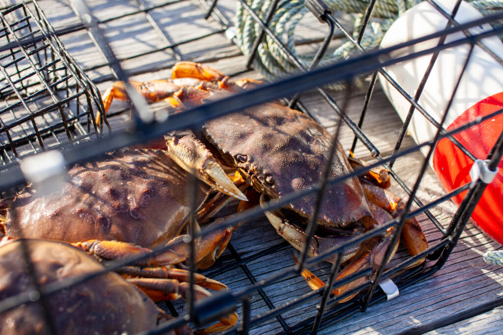
area must be a **** poor producer of crab,
"But for three or four months every year, transient recreational fishers flocked to the central coast and, together with a handful of commercial operators, harvested so many crabs that for the rest of the year, local Indigenous communities were left with the dregs — depleted populations and crabs under the legal size limit for harvesting. "
Vancouver gets hit so hard and yet its still pretty easy to get nice keepers ever trip.
Sharphooks
Well-Known Member
Yup, Blackdog got it right—-this will be the “Landmark” case that’s used as a blueprint to justify and provide irrefutable evidence for closing areas to all salmon and halibut fishing. You can smell it in the air....
ship happens
Well-Known Member
B.C. First Nations, Fisheries and Oceans Canada protect crab for Indigenous food, social and ceremonial purposes | The Narwhal
Groups agree to close 17 Dungeness crab harvest sites on the central coast to commercial and recreational fishing in landmark decision
Rapid recovery of Dungeness crab within spatial fishery closures declared under indigenous law in British Columbia
Canada’s constitution grants indigenous people priority access to marine resources, yet indigenous, commercial and recreational fishers target the sam…www.sciencedirect.com
I just threw up a little bit
Not sure if the narwhale counts as unbiased news. There were many other measures that could have been tried before implementing full closures, but the request was to close, not explore management options. There are rumours of a right based commercial crab fishery being discussed so it will be interesting to see if any closures apply to that fishery if it starts up.
ship happens
Well-Known Member
Its not about conservation. Its about the FN wanting the fishery. Then what, then no more salmon fishing? Unless your a FN? The federally owned crown land, the land that our tax dollars have managed all these years is being handed over to FN. **** me.
Pretty soon im just going to leave this place. Mexico here I come.
Your welcome Kaitsoo Band for fixing all your roe on kelp skiffs over the last several years!
Pretty soon im just going to leave this place. Mexico here I come.
Your welcome Kaitsoo Band for fixing all your roe on kelp skiffs over the last several years!
Sharphooks
Well-Known Member
Same thing going on with the steelhead and chinook in the Skeena system and fights to control the river frontage those fish swim past. Even without the border closures last September I knew I was done up there... first trip was 1976 and I never missed a season for all those years, but I could see the writing on the wall over the last four or five years and it was time to pull the plug
In my neighborhood we have a federally mandated “treaty” called the Boldt Decision. I remember how furious some people were back in the 70’s when it first became law...
Right about now, watching what’s happening up in Central Coast and REgion VI, for the non-FN fishers like me, in retrospect the Boldt Decision looks like a very prudent approach to managing natural resources across all user groups.....
50 % sure sounds better then nothing...
ship happens
Well-Known Member
I didnt take any liking to the part of the article where the FN threatened the feds and the feds just rolled over.
Then they started salmon is next. So what now? Rivers inlet will be shut down for sports fishing before we know it?
Then they started salmon is next. So what now? Rivers inlet will be shut down for sports fishing before we know it?
Similar threads
- Replies
- 3
- Views
- 611