Navionics App, SonarChartsLive function

Seagirt

Active Member
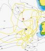
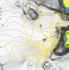
Has anyone made use of the Navionics App's new function, SonarChartsLive, to add higher resolution bathymetry to their charts at the moment they are collecting the data? Navionics has been incorporating user data into their charts with a turn around time of (they say) a week but having it instantly with SonarChartsLive is much more appealing.

A wifi connection with your sounder is required, and some sounders have this built in. An alternative, if your fishfinder outputs depth data as NMEA, is sonarserver. Sonarserver outputs your depth data as a wifi signal that your phone or tablet connects to. The phone stores these newly created maps for later use. The more coverage you get of an area the more detail it adds to your charts, and it does so instantly.

Anyone used the Sonarlive yet?

See Navionics Sonarchartlive http://www.navionics.com/en/sonarchart-live
and www.sonarserver.com
 
I use it all the time the combination of instant live mapping on my iPad and then uploaded to my map card after processing is awesome
 
Lowrance/Simrad have a similar app. You log your sonar plots on an SD card and upload them to their Insight Genesis service. It will then instantly convert them to a chart which you can then load back into the plotter. Haven't tried it yet. They have a free social maps for part of the Juan de Fuca straight but I didn't find it any more valuable than the Navionics chip already on the boat. The current free maps show a section of the Victoria waterfront from Clover to the breakwall, a stretch by the Royal Victoria Golf Course and a stretch over by Border Bank.
 
Last edited by a moderator:
Is it the same as insite mapping. I use that service quite a bit. Basically I just record the whole day of trolling. Upload, merge multiple days together and use on the hds unit when back in the same areas. I have uploaded and they are on the social map but you can't see them. Gofree was looking into it. The social map is still listed as beta and that maybe why.
 
no its not the same at all.

I use the USA & Canada App, then it detects my active t-box (you will too if your boat passes by me)

the charts that are on the screen show the bottom, in 1 FOOT increments. Banks and walls and bottom structure appear in BOLD since the lines are so tight.

as you pass over the bottom, the map updates with new contour shapes. with every pass it becomes more defined.


attachment.php
attachment.php
 

Attachments

  • path.jpg
    path.jpg
    13.7 KB · Views: 390
  • path2.jpg
    path2.jpg
    20.2 KB · Views: 390
Last edited by a moderator:
does look interesting
sortta looks the same, this is overlaid on google earth, just not live requires processing to the web for sharing purposes. can this mapping be shared? when finished will it save for use next time?


doesn't work on hds2 tho, only lowrance hds3
 

Attachments

  • Capture.jpg
    Capture.jpg
    20.7 KB · Views: 143
  • Capture2.jpg
    Capture2.jpg
    20.1 KB · Views: 143
Last edited by a moderator:
the navionics app auto uploads the fresh data to navionics site for analysis

they publish many updates per day.

you can even go into your profile and see all your contributions
(usually takes 48h for them to verify them before making live as a community edit)


when using the navionics app, there is a setting to include community edits or just use the base map


some of you may have heard of Dr.Depth software, which I believe was bought out by them
 
Is it possible to keep the data collected and the created map all to oneself (in regards to Sonarchartslive)? I'd like more detailed maps of a few of my favourite places but not if that means uploading those data to navionics for the community and drawing other angler's attentions to those areas. Call me selfish, but I've spent long fishless hours on anchor and I'd like to keep some of the good spots to myself for a while.
 
Back
Top