Navigating from Victoria to Nootka Sound

pescador

Well-Known Member
Can anyone tell me there experience in navigating from Victoria up the West Coast to Nootka Sound? How long does it take? What are your favoured stop points. Where do you fuel in route? What navigational risk does one face (IE rocks awash)? What should one avoid etc. Any tips would be appreciated.

Matador
 
It’s about 185 miles to Friendly Cove. I usually plan my trip averaging 20 knots. The time will vary depending on your boat, speed, and weather. You can run up the outside all the way in good weather and there are two sections that can be done in more protected waters inside "Broken Group" and "Tofino" – around the inside of “Flores Island”) if the weather turns on you? The cheapest gas I have found is at the grocery store in “Ahousaht”, which also has a cheap motel right near the dock. That is on Flores Island.

Start early and plan on running in the “fog”. Keep an eye on the weather rounding “Cape Beale” and Estevan Point”, they can get a little rough in the afternoons? I usually round Estevan about 5 miles off the point. Coming in from the south the first time watch your course and give the rocks at Escalante some room. Don’t be surprised when you run into 15 foot swells! There are a "few" un-charted rocks in the Broken Group, but if you stay in the main channels, won't be an issue.

Radar and a backup GPS, would be a very good thing!

btw... Charlie would be on a business trip in a place called Florida. Which is cold and wet, right now? :)
 
FYI.... there have been some rumours of water in the fuel @ Ahousat. All the watertaxis running out of there have been fueling up in Tofino the last year or so.
 
quote:Originally posted by Tofinoguy

FYI.... there have been some rumours of water in the fuel @ Ahousat. All the watertaxis running out of there have been fueling up in Tofino the last year or so.
FYI... I have gotten fuel there the last two years without any problems, at all??? [?]

Are you talking "rumors" or "fact"? [?][?][?]
 
quote:Originally posted by Charlie

quote:Originally posted by Tofinoguy

FYI.... there have been some rumours of water in the fuel @ Ahousat. All the watertaxis running out of there have been fueling up in Tofino the last year or so.
FYI... I have gotten fuel there the last two years without any problems, at all??? [?]

Are you talking "rumors" or "fact"? [?][?][?]
My information comes from the Ahousats i know that run water taxis to Tofino daily. They are fueling up @ Method Marine (in Tofino), where we moor our boats before they go back to Ahousat. Maybe the quality is better in the summer?
 
Charlie, do you run solo or with other boats? What about size. What's the smallest size boat you think could do the trip safely? Do you do the trip in one day? Thanks for your insight....also, you on the Gulf Coast right now or Atlantic side? You must be drooling over the inventory of boats down there for sale......

Matador
 
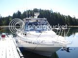
I am in Jacksonville (Atlantic side) and yes I have seen some “nice” boats… “cheap”! But not drooling as I have a nice boat… the reason I have a nice boat is “that” run.

I have made that run since 1997 and have always been solo. And might I add… when I first started there was quite a few times I felt awfully lonely, especially in the fog. Once I got my radar and realized fog means good water, I got use to that. I would rather have fog and flat seas, than clear which usually means rougher water and larger swells? I draw “my line” at “storm” warnings, but again that is a boat and comfort level. There is absolutely no doubt… You need to remember, the farther up the WCVI you get, you are basically on your own out there... most of the time? Be ready to deal with that. Unless, there happens to be a fishing boat, sailboat, or coast guard cutter in the area… it can be up to 4/5 hours for someone to get to you?

Size??? There are times I would be comfortable in a 17’ and times I have turned around in a 42’. It all has to do with comfort level and “weather”! The boats will usually do a lot more than “we” will, but personally I would not do it in less than a 20’, anymore? It also must be an age thing as I would not want to do it without radar, again anymore? Remember… I said don’t be surprised when you run into 15’ swells! That is more the norm than the exception, unless you wait and time the seas and weather? You will usually find those leaving the Strait around Cape Beale and rounding Estevan. If you ever decide to go farther up they will also be at Brooks Peninsula and often at Cape Scott? I always… always… always, get a weather update prior to those points, both on the way up and back down!

Most times Victoria to Nootka is an easy one day run, but again it is a weather thing. I have had wait 2 days… as I don’t like to venture out in 50 knot winds and 30’ foot seas. Yes, been there… done that, on that run! If you don’t know what “sea state” means, learn that!!!!

With all that being said… plan on taking your time, watch the weather, and enjoy the trip! You are getting ready to do something most have not and it is a “trip of a lifetime”! That’s why I do it every year!


DSC01311-1-2.jpg
 
Back
Top