Copper Moon
Well-Known Member
[
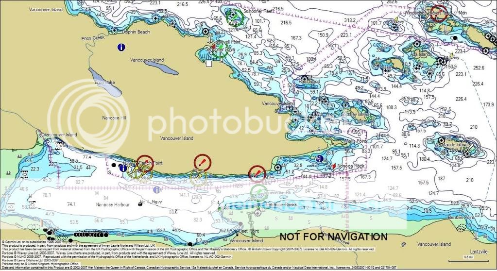
I own VCA500L. Approach to Nanoose Harbour is there. As far as G2 not having 3459 Approaches to Nanoose Harbour listed, it is not. No need as it would be duplicate coverage of the same area. G2 does have the more detailed maps listed, including Ca570193 which is a 1:7500 verses 3459 which is 1:15000. BlueChart V9.5 actually shows that.
Your missing link is here: http://www8.garmin.com/cartography/g2vision/card.jsp?sku=VCA500L
This starting to be very educational, at least to me. The website I looked at back when showed a lot of detail charts within 3512 ( Georgia Strait Central) but not the Nanoose detail. I would have preferred the Garmin over my Eagle, but my understanding of the coverage drove my decision. I don't follow how you can determine the coverage area from that listing, but if its alright by you I would like to followup via email.