
Tyler Brinks
Member
Sharing this news from Navionics about the expanded coverage in BC.
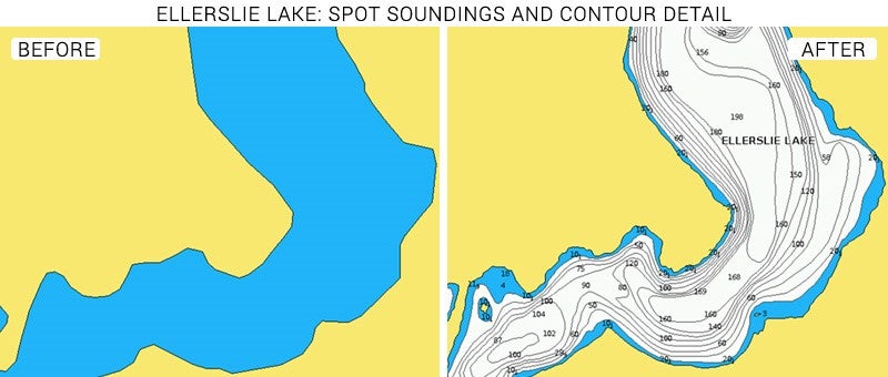
Cartography updates have recently been made to several lakes in British Columbia, Canada, including the addition of new lakes and updated detail. Updates include shoreline improvements and new spot soundings. Ellerslie, Euchuiniko and Tesla lakes also have new contour detail.
Lakes included are: Tesla Lake, Whitesail, Choelquoit Lake, Euchiniko Lake, Ellerslie Lake, Thutade Lake, and Dinosaur Lake.
You can see the entire post here: https://www.navionics.com/usa/blog/...QX_8PFIBqIsCKctHwkyFczn6AE-rcW5NvTImDJMTogDmM
Here is an example of some of the improvements.