frenchcreek
Member
I have a Lowrance HDS-10 Gen 2. I would like to find a way to put the rockfish closure areas on the chart so they always show. Is there a simpler way to do this other than creating routes?
") Does someone have a step by step way of doing this? They can PM me to explain off-line.
Does someone have a step by step way of doing this? They can PM me to explain off-line.If you know what you are doing, it sounds easy
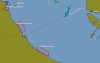
Nothing there for Area 14https://sites.google.com/site/rockfishconservationareas/
If the rca file is here then copy onto an SD card from computer
Insert SD card into head unit
Go to the page files and select import files and follow instructions
Go to your chart page and verify its there
So, I open the link, scrolled down to area 29 Galiano Island North, scrolled across the page to the white down arrow, click on the arrow, a gpx file opens in pdf, but, it won't import?Google earth is your friend when viewing on a computer
No need to open for GPS units just save/ import. Should work on all platforms or units
Is there one that has area 14 on it?Here is a previous thread on this topic:
http://www.sportfishingbc.com/forum...rcas-on-lowrance-hds.63907/page-2#post-801855
I got the RCA file from Charlie415
Then I imported it to my HDS 7- very simple
i downloaded the same fileSo, I open the link, scrolled down to area 29 Galiano Island North, scrolled across the page to the white down arrow, click on the arrow, a gpx file opens in pdf, but, it won't import?