
You are using an out of date browser. It may not display this or other websites correctly.
You should upgrade or use an alternative browser.
You should upgrade or use an alternative browser.
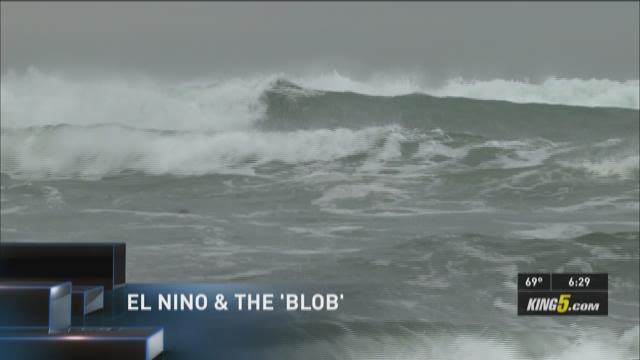
'Warm blob' of water in Pacific Ocean could hurt salmon
- Thread starter agentaqua
- Start date
OldBlackDog
Well-Known Member
So, I see you cannot tell us what party will solve this?
Once again, the Blob is not caused by global warming!
El Niño is here again and that is not due to Global warming.
We have had it before and will again.
Once again, the Blob is not caused by global warming!
El Niño is here again and that is not due to Global warming.
We have had it before and will again.
What party will fix it you ask... why the ABC party that's who.
So your still on that AGW hoax theory then explain this....
Think those CEOs of oil companies that represent nearly $1.4 trillion in annual revenue are in on the hoax too?
or should we invest in Alcan to protect our wallets and our heads?
GLG
Well-Known Member
Once again, a conservation thread that ends up completely off topic and inevitably degenerates into a fight about global warming, political debate and big industry. Stick to the topic or it disappears.
Sorry admin will try to stick to the topic of the Blob and what it means to salmon.
GLG
Well-Known Member
So, I see you cannot tell us what party will solve this?
Once again, the Blob is not caused by global warming!
El Niño is here again and that is not due to Global warming.
We have had it before and will again.
Can you supply a link that ties El Niño to the blob?
My understanding is that the two are separate issues.
OldBlackDog
Well-Known Member
Yes they are separate, yet effect the same way.
[h=1]El Nino and warm water 'blob' affecting Northwest weather[/h]SEATTLE - The National Climate Prediction Center says a weak El Nino should be with us through December at least.
El Nino has the effect of keeping the fall and winter climate in the Pacific Northwest warmer and drier than normal. El Nino forms when a warm pool of water at the surface of the Pacific Ocean along the equator builds up along the west coast of South and Central America. This El Nino is expected to be weak.
The bigger effect is coming from something like El Nino and much closer to the Pacific Northwest. It's called "the blob," another big pool of warmer than normal water. The blob is off the Washington coast and goes north, pretty much filling the Gulf of Alaska. At its warmest point, it's five degrees warmer than normal, and as the air blows across it, that air also becomes warmer as it heads over land. El Nino's effects are largely confined to the fall and winter months, but "the blob" helped create a warmer summer than normal.
In May, Washington state climatologist Nick Bond with the University of Washington had forecast a warmer and more humid summer for 2014 because of the blob. And now looking back?
"Clearly, it's a warmer than normal summer." he said.
El Nino and warm water 'blob' off the Pacific Northwest coast is affecting our weather. Glenn Farley reports. KING
He said summer temperatures were four degrees higher than average. Bond also had fears about what the blob would do, and in that same May interview remarked that the summer could bring an active fire season. As it turned out, the fire season set a new record for the largest fire in state history.
The blob first appeared last winter, and Bond says it led to a drier and warmer first half of the 2013-2014 winter season, although strong rains in early 2014 more than made up for it. Even during the sunny, warm summer, several big downpours balanced out the precipitation effects of the blob.
Bond is now writing a scientific paper on the unusual blob. And the blob isn't going away. He forecasts its effects will be felt over this winter.
"Warmer and drier. Perhaps a few less wind storms than usual. But again, there's so much variability in the system," said Bond. "To push the casino analogy, there are so many wild cards."
And yes, he's expecting there to be a ski season and a decent snow pack.
http://www.nwfsc.noaa.gov/news/features/food_chain/index.cfm
"Peterson recently advised the Northwest Power and Conservation Council that juvenile salmon and steelhead migrating from the Columbia River to the ocean this year and next may experience poor survival.
"The signs for salmon aren't good based on our experience in the past," Peterson said, "but we won't really see the signal from this until those fish return in a few years." The warm expanse in the Gulf of Alaska is a kind of climatic "hangover" from the same persistent atmospheric ridge of high pressure believed to have contributed to California's extreme drought, Bond and Mantua said. The ridge suppressed storms and winds that commonly stir and cool the sea surface. "
http://www.saanichnews.com/news/297418151.html
"It could further affect the pole-ward migration of marine life already occurring along the Pacific coast.
“West Coast fishermen are chasing tuna to Alaska,” Okey says. “Fishermen recently caught a skipjack tuna – a tropical fish – in the mouth of the Copper River, one of Alaska’s most iconic salmon rivers.” "
http://www.nwcouncil.org/media/7119836/1.pdf
Wiseguy
Member
Thank you, Admin...Once again, a conservation thread that ends up completely off topic and inevitably degenerates into a fight about global warming, political debate and big industry. Stick to the topic or it disappears.
GLG
Well-Known Member
So this thread is about the blob and the science paper that laid out the evidence and the effects for our salmon.
http://onlinelibrary.wiley.com/doi/10.1002/2015GL063306/full
The question is what caused the blob and as someone pointed out it was a high in the North Pacific. That said the next question should be what caused the high in the North Pacific. The author of the paper Nicholas Bond did not go into the cause in his paper but has since written more about it. He is also one of the interviewed scientist it the last video I posted. Here is what he wrote on another website. For those that would like a quick summary I'll underline the important stuff.
https://theconversation.com/what-is...can-it-tell-us-about-our-future-climate-40140
What is the ‘warm blob’ in the Pacific and what can it tell us about our Future climate?
People living across the US have lived through some odd weather in the past year. It’s been unusually warm and dry in the western US, while the East had a very cold and snowy winter. Meanwhile, scientists have been seeing Pacific marine species in places they’re not normally found and a huge spike in hungry, stranded sea lion pups on California shores. All these phenomena are linked to a giant patch of remarkably warm water off the West Coast in the northeast Pacific Ocean called “the blob,” a term I coined when we first started to notice it during the fall of 2013 and winter of 2014.This piece summarizes the mechanisms responsible for the blob, enumerates some of its direct and indirect impacts, and discusses the opportunity provided by this climate event. Better understanding the blob is important not only to predicting weather and its impact on ecosystems but also because it can provide insight into the effects we could see from warmer ocean waters in the future.
Blob 101
The development of the blob of unusually warm water can be attributed largely to an unusual weather pattern that set up shop over a large region extending from the North Pacific Ocean across North America from October 2013 into February 2014.This pattern featured a strong and long lasting weather pattern with higher than normal pressure – called a ridge – over the ocean centered offshore of the Pacific Northwest. This ridge of high pressure reduced the number and intensity of storms making landfall, leading to reduced precipitation west of the Continental Divide compared to seasonal norms.The ridge also had profound effects on the weather farther east. Specifically, it often acted to divert cold, Canadian air into the middle and eastern sections of the US, with the Great Lakes region being hit especially hard.

The unusually dry conditions in the western US (plus south coast of BC) and the frigid weather farther east definitely got the attention of the climate community. But what happened in the ocean off the Pacific Northwest was extreme in its own right.The sea surface temperature anomalies – or differences from average temperatures –became greater than 2 Celsius (3.6 Fahrenheit) by late winter. That may not seem very impressive, but for the region it’s actually without precedent in the historical record. Moreover, the quasi circular nature of the patch of warm water anomalies (and the reason for its name) had also not been seen before. This motivated investigation of the source(s) of all the extra heat. In a study published earlier this month, my colleagues and I fingered the stubborn high pressure ridge mentioned above, and in particular the weak winds associated with it. The result was a lower than normal rate in how quickly heat is transferred from the ocean to the atmosphere, and slower movement of cooler water into the formation region of the blob. In other words, the unusual atmospheric conditions produced less cooling than typical for the season from fall 2013 through much of the following winter, yielding the sea surface temperature anomaly pattern. So we can essentially blame the ridge for the blob, but what caused the ridge in the first place?
Finding the origin
Two independent lines of inquiry, including a study last year led by Richard Seager and one from March led by Dennis Hartmann, indicate that the unusual atmospheric circulation over the North Pacific and North America could be attributed at least in part to happenings in the far western tropical Pacific. A large expanse of ocean here has been warmer than normal for a few years and has been accompanied by vigorous clusters of thunderstorms. This activity appears to have systematic effects on the large scale atmospheric circulation, in a manner similar to that associated with the El Niño Southern Oscillation (ENSO) phenomenon, a pattern of naturally occurring fluctuations in Pacific Ocean temperatures. But in this case, the roots are farther west, in the vicinity of New Guinea.

Previous work had suggested that this portion of the tropical Pacific could have systematic effects on higher latitudes, including the ridge of high pressure producing the blob. But the work by Seager et al and Hartmann represents an important advance in our understanding of this linkage. A vast amount of extra heat is associated with ocean temperature anomalies of the sort shown in the image below. But while these anomalies tend to be persistent, they are not static.

The ocean circulation – that is, the currents – and the weather during the past year, which was unusual in its own right, combined to cause the blob to evolve into a wide strip of relatively warm water along the entire West Coast of North America (see image, below)

This happens to be a pattern that has occurred before in association with decades long shifts in ocean temperature known as the Pacific Decadal Oscillation (PDO). Previous expressions of the PDO have had major and wide ranging impacts on the marine ecosystem including salmon and other species of fish; recent developments are receiving a great deal of attention from fishery oceanographers along the West Coast
Learning opportunity
An extreme event such as the blob represents a special opportunity to determine how the ocean’s biochemical properties respond to changes in the physical environment. Following up on that idea, the lessons learned from the present case have implications from a climate change perspective. It bears emphasizing that the development and evolution of the blob is an example of a naturally occurring, short term perturbation in the atmosphere and ocean climate of the North Pacific. Nevertheless, the oceans are warming, and conditions akin to those of the last couple of years are liable to become more common in future decades, albeit for different reasons.We hope to use what nature has provided us recently with the blob. By studying its effects, such as changes to marine ecosystems or coastal forests, we can learn how sensitive, or resilient, these natural systems are to a warming world.
.............................
So the next thing to think about is positive PDO. How long do they last and what's the effect? My reading is that it can last from 10 to 20 years and Alaska is the only one that wins. We could be in for a rough ride if it gets confirmed that we have shifted to a positive PDO. Lets hope this blob goes away and things go back to normal, if not we will be in for some records and they won't be good ones.
info on PDO and it's effect on salmon
http://research.jisao.washington.edu/pdo/
http://onlinelibrary.wiley.com/doi/10.1002/2015GL063306/full
The question is what caused the blob and as someone pointed out it was a high in the North Pacific. That said the next question should be what caused the high in the North Pacific. The author of the paper Nicholas Bond did not go into the cause in his paper but has since written more about it. He is also one of the interviewed scientist it the last video I posted. Here is what he wrote on another website. For those that would like a quick summary I'll underline the important stuff.
https://theconversation.com/what-is...can-it-tell-us-about-our-future-climate-40140
What is the ‘warm blob’ in the Pacific and what can it tell us about our Future climate?
People living across the US have lived through some odd weather in the past year. It’s been unusually warm and dry in the western US, while the East had a very cold and snowy winter. Meanwhile, scientists have been seeing Pacific marine species in places they’re not normally found and a huge spike in hungry, stranded sea lion pups on California shores. All these phenomena are linked to a giant patch of remarkably warm water off the West Coast in the northeast Pacific Ocean called “the blob,” a term I coined when we first started to notice it during the fall of 2013 and winter of 2014.This piece summarizes the mechanisms responsible for the blob, enumerates some of its direct and indirect impacts, and discusses the opportunity provided by this climate event. Better understanding the blob is important not only to predicting weather and its impact on ecosystems but also because it can provide insight into the effects we could see from warmer ocean waters in the future.
Blob 101
The development of the blob of unusually warm water can be attributed largely to an unusual weather pattern that set up shop over a large region extending from the North Pacific Ocean across North America from October 2013 into February 2014.This pattern featured a strong and long lasting weather pattern with higher than normal pressure – called a ridge – over the ocean centered offshore of the Pacific Northwest. This ridge of high pressure reduced the number and intensity of storms making landfall, leading to reduced precipitation west of the Continental Divide compared to seasonal norms.The ridge also had profound effects on the weather farther east. Specifically, it often acted to divert cold, Canadian air into the middle and eastern sections of the US, with the Great Lakes region being hit especially hard.
The unusually dry conditions in the western US (plus south coast of BC) and the frigid weather farther east definitely got the attention of the climate community. But what happened in the ocean off the Pacific Northwest was extreme in its own right.The sea surface temperature anomalies – or differences from average temperatures –became greater than 2 Celsius (3.6 Fahrenheit) by late winter. That may not seem very impressive, but for the region it’s actually without precedent in the historical record. Moreover, the quasi circular nature of the patch of warm water anomalies (and the reason for its name) had also not been seen before. This motivated investigation of the source(s) of all the extra heat. In a study published earlier this month, my colleagues and I fingered the stubborn high pressure ridge mentioned above, and in particular the weak winds associated with it. The result was a lower than normal rate in how quickly heat is transferred from the ocean to the atmosphere, and slower movement of cooler water into the formation region of the blob. In other words, the unusual atmospheric conditions produced less cooling than typical for the season from fall 2013 through much of the following winter, yielding the sea surface temperature anomaly pattern. So we can essentially blame the ridge for the blob, but what caused the ridge in the first place?
Finding the origin
Two independent lines of inquiry, including a study last year led by Richard Seager and one from March led by Dennis Hartmann, indicate that the unusual atmospheric circulation over the North Pacific and North America could be attributed at least in part to happenings in the far western tropical Pacific. A large expanse of ocean here has been warmer than normal for a few years and has been accompanied by vigorous clusters of thunderstorms. This activity appears to have systematic effects on the large scale atmospheric circulation, in a manner similar to that associated with the El Niño Southern Oscillation (ENSO) phenomenon, a pattern of naturally occurring fluctuations in Pacific Ocean temperatures. But in this case, the roots are farther west, in the vicinity of New Guinea.
Previous work had suggested that this portion of the tropical Pacific could have systematic effects on higher latitudes, including the ridge of high pressure producing the blob. But the work by Seager et al and Hartmann represents an important advance in our understanding of this linkage. A vast amount of extra heat is associated with ocean temperature anomalies of the sort shown in the image below. But while these anomalies tend to be persistent, they are not static.
The ocean circulation – that is, the currents – and the weather during the past year, which was unusual in its own right, combined to cause the blob to evolve into a wide strip of relatively warm water along the entire West Coast of North America (see image, below)
This happens to be a pattern that has occurred before in association with decades long shifts in ocean temperature known as the Pacific Decadal Oscillation (PDO). Previous expressions of the PDO have had major and wide ranging impacts on the marine ecosystem including salmon and other species of fish; recent developments are receiving a great deal of attention from fishery oceanographers along the West Coast
Learning opportunity
An extreme event such as the blob represents a special opportunity to determine how the ocean’s biochemical properties respond to changes in the physical environment. Following up on that idea, the lessons learned from the present case have implications from a climate change perspective. It bears emphasizing that the development and evolution of the blob is an example of a naturally occurring, short term perturbation in the atmosphere and ocean climate of the North Pacific. Nevertheless, the oceans are warming, and conditions akin to those of the last couple of years are liable to become more common in future decades, albeit for different reasons.We hope to use what nature has provided us recently with the blob. By studying its effects, such as changes to marine ecosystems or coastal forests, we can learn how sensitive, or resilient, these natural systems are to a warming world.
.............................
So the next thing to think about is positive PDO. How long do they last and what's the effect? My reading is that it can last from 10 to 20 years and Alaska is the only one that wins. We could be in for a rough ride if it gets confirmed that we have shifted to a positive PDO. Lets hope this blob goes away and things go back to normal, if not we will be in for some records and they won't be good ones.
info on PDO and it's effect on salmon
http://research.jisao.washington.edu/pdo/
Last edited by a moderator:
GLG
Well-Known Member
http://www.nwfsc.noaa.gov/news/features/food_chain/index.cfm
"Peterson recently advised the Northwest Power and Conservation Council that juvenile salmon and steelhead migrating from the Columbia River to the ocean this year and next may experience poor survival.
"The signs for salmon aren't good based on our experience in the past," Peterson said, "but we won't really see the signal from this until those fish return in a few years." The warm expanse in the Gulf of Alaska is a kind of climatic "hangover" from the same persistent atmospheric ridge of high pressure believed to have contributed to California's extreme drought, Bond and Mantua said. The ridge suppressed storms and winds that commonly stir and cool the sea surface. "
http://www.saanichnews.com/news/297418151.html
"It could further affect the pole-ward migration of marine life already occurring along the Pacific coast.
“West Coast fishermen are chasing tuna to Alaska,” Okey says. “Fishermen recently caught a skipjack tuna – a tropical fish – in the mouth of the Copper River, one of Alaska’s most iconic salmon rivers.” "
http://www.nwcouncil.org/media/7119836/1.pdf
Thanks for the links AA... That's the first time I have read of a link between the loss of Arctic sea ice and the blob. That cant be good...
 if that gets confirmed. Looks like we may be in for another record up there as things are melting fast this year. On track for another 2012 low or worse.
OldBlackDog
Well-Known Member
Because we have been there before this will give you all information on what is happening now.
http://www.pmel.noaa.gov/tao/elnino/nino-home.html
http://www.pmel.noaa.gov/tao/elnino/nino-home.html
GLG
Well-Known Member
Because we have been there before this will give you all information on what is happening now.
http://www.pmel.noaa.gov/tao/elnino/nino-home.html
Thanks for the link .... you say "we have been there before" could you tell when that was?
OldBlackDog
Well-Known Member
1997-1998.http://ww2010.atmos.uiuc.edu/(Gh)/guides/mtr/eln/rcnt.rxml
Thanks for the link .... you say "we have been there before" could you tell when that was?
GLG
Well-Known Member
[h=1]Ocean 'blob' of warm water bringing poor food for B.C. wild salmon[/h]
[h=3]University of Victoria researcher finds unusual 'squishy' zooplankton in warmer water[/h]Jun 08, 2015

A University of Victoria oceanographer studying the so-called "warm blob" of water off the B.C. coast has observed unusual, "squishy" visitors from the south — and that could be bad news for young salmon.
John Dower, who just returned from a research cruise north of Vancouver Island, said he saw remarkably high amounts of tiny animals called zooplankton in the "blob," a huge mass of ocean water about 2 degrees warmer than normal.
And the varieties he saw are normally found off northern California — not Canada.
"These are really not very good food for most of the species that normally rely on plankton," said Dower.
Young salmon rely on zooplankton for food — but the jelly-like species that seem to be thriving in the warmer waters have much less nutrition than the normal cold-water species.
[h=2]'Crunchies' vs. 'Squishies'[/h]Dower and other researchers have been concerned what might be happening to the important food source as the water off the B.C. coast has warmed over the past year and a half.
"We were quite keen to get out here and see what was going on," he said.
"One way to think about plankton is you've got your crunchies and you've got your squishies"
The species that usually dominate in colder water tend to be "crunchies," he said: krill and other shrimp-like animals that are high in nutritious fatty acids and oils.
"What we're seeing is a lot of [squishies], gelatinous types of zooplankton, and they're not nearly as nutritious as the normal species of plankton that we find off the coast here."
Dower worries what the change will mean for juvenile salmon heading out to sea, as well as other sea birds and marine mammals.
"It makes us start to wonder what it's going to mean in terms of their ... growth and survival this coming year."
[h=3]University of Victoria researcher finds unusual 'squishy' zooplankton in warmer water[/h]Jun 08, 2015
A University of Victoria oceanographer studying the so-called "warm blob" of water off the B.C. coast has observed unusual, "squishy" visitors from the south — and that could be bad news for young salmon.
John Dower, who just returned from a research cruise north of Vancouver Island, said he saw remarkably high amounts of tiny animals called zooplankton in the "blob," a huge mass of ocean water about 2 degrees warmer than normal.
And the varieties he saw are normally found off northern California — not Canada.
"These are really not very good food for most of the species that normally rely on plankton," said Dower.
Young salmon rely on zooplankton for food — but the jelly-like species that seem to be thriving in the warmer waters have much less nutrition than the normal cold-water species.
[h=2]'Crunchies' vs. 'Squishies'[/h]Dower and other researchers have been concerned what might be happening to the important food source as the water off the B.C. coast has warmed over the past year and a half.
"We were quite keen to get out here and see what was going on," he said.
"One way to think about plankton is you've got your crunchies and you've got your squishies"
The species that usually dominate in colder water tend to be "crunchies," he said: krill and other shrimp-like animals that are high in nutritious fatty acids and oils.
"What we're seeing is a lot of [squishies], gelatinous types of zooplankton, and they're not nearly as nutritious as the normal species of plankton that we find off the coast here."
Dower worries what the change will mean for juvenile salmon heading out to sea, as well as other sea birds and marine mammals.
"It makes us start to wonder what it's going to mean in terms of their ... growth and survival this coming year."
OldBlackDog
Well-Known Member
You might like this.
https://watershed.ucdavis.edu/skeena_river/documents/initial_reports/SKhanna.pdf
https://watershed.ucdavis.edu/skeena_river/documents/initial_reports/SKhanna.pdf
GLG
Well-Known Member
Thanks that dates looks familiar... perhaps its because it's 18 years and 4 month's ago from the last time you posted that nugget of info.... care to predict the weather and what that means for salmon or do you think that is not possible?

OldBlackDog
Well-Known Member
I see you have moved off topic.
To get back on, yes we had huge warming before and the salmon survived.
These have been going on forever and the salmon are still here.
This has nothing to do with global warming.
To get back on, yes we had huge warming before and the salmon survived.
These have been going on forever and the salmon are still here.
This has nothing to do with global warming.
Thanks that dates looks familiar... perhaps its because it's 18 years and 4 month's ago from the last time you posted that nugget of info.... care to predict the weather and what that means for salmon or do you think that is not possible?
GLG
Well-Known Member
I see you have moved off topic.
To get back on, yes we had huge warming before and the salmon survived.
These have been going on forever and the salmon are still here.
This has nothing to do with global warming.
Yes let's not talk about AGW.
Still I would like you to answer the question...
care to predict the weather and what that means for salmon or do you think that is not possible?
You seem to have done your homework and now should be able to gives us an educated prediction of what the weather is going to be like for the next several months. I don't expect you to say what day it's going to rain or if there will be a thunder storm July 15 but you should be able to tell us something. Just a general trend ie dryer then normal or wetter the normal. Will it be a foggy August or not so much. Cooler average temps or warmer then average temps.
Yes 1998 was huge warming. I think they called that a super el nino, the salmon survived but did they prosper or did they just get by. Did they go into decline?
The thing that is different this time is the BLOB. That's the wild card and to me understanding that and looking down the road is troubling.
OldBlackDog
Well-Known Member
Here is Canada's history on projecting the weather.
Notice that for 90 percent of Canada the forecast average accuracy is given as 41.5 percent. A coin toss gives far better odds.
So, we will have to let nature decide what is going to happen.
Notice that for 90 percent of Canada the forecast average accuracy is given as 41.5 percent. A coin toss gives far better odds.
So, we will have to let nature decide what is going to happen.
Yes let's not talk about AGW.
Still I would like you to answer the question...
care to predict the weather and what that means for salmon or do you think that is not possible?
You seem to have done your homework and now should be able to gives us an educated prediction of what the weather is going to be like for the next several months. I don't expect you to say what day it's going to rain or if there will be a thunder storm July 15 but you should be able to tell us something. Just a general trend ie dryer then normal or wetter the normal. Will it be a foggy August or not so much. Cooler average temps or warmer then average temps.
Yes 1998 was huge warming. I think they called that a super el nino, the salmon survived but did they prosper or did they just get by. Did they go into decline?
The thing that is different this time is the BLOB. That's the wild card and to me understanding that and looking down the road is troubling.
Attachments
OldBlackDog
Well-Known Member
From our neighbours in WA.
[COLOR=rgb(99.999603%, 100.000000%, 100.000000%)]OWSC Newsletter June 5, 2015! Page 8[/COLOR]
Climate Outlook
El Niño conditions have strengthened in the equatorial Pacific Ocean. Averaged over the lastfour weeks, sea surface temperatures (SSTs) were above normal throughout the equatorialPacific as well as most of the eastern Pacific Ocean, according to the Climate Prediction Cen-ter (CPC): [COLOR=rgb(0.670023%, 11.771740%, 66.518936%)]http://www.cpc.ncep.noaa.gov[/COLOR]. The strongest equatorial SST anomalies are cur-rently off the South American coast, and exceed 3°C. The “El Niño Advisory” released on 5March is still in effect. There is an approximately 90% chance that El Niño conditions willcontinue through the summer of 2015, and a greater than 80% chance it will last through theend of the calendar year.
 !The Climate Prediction Center seasonal outlook for June is calling for increased chances ofabove normal temperatures statewide, with the highest chances of warmer than normal tem-peratures west of the Cascade Mountains. The June precipitation outlook is calling for higherchances of below normal precipitation for the western WA, and equal chances of above, equalto, or below normal precipitation in eastern WA.
The summer (June-July-August; JJA) CPC outlook is very similar to the June outlook.There are higher chances of above normal temperatures for all of WA state with the highestchances for locations west of the Cascade Mountains. For precipitation, there are equalchances of below, equal to, or above normal precipitation in eastern WA but increasedchances of below normal precipitation in western WA.
[COLOR=rgb(99.999603%, 100.000000%, 100.000000%)]OWSC Newsletter June 5, 2015! Page 8[/COLOR]
Climate Outlook
El Niño conditions have strengthened in the equatorial Pacific Ocean. Averaged over the lastfour weeks, sea surface temperatures (SSTs) were above normal throughout the equatorialPacific as well as most of the eastern Pacific Ocean, according to the Climate Prediction Cen-ter (CPC): [COLOR=rgb(0.670023%, 11.771740%, 66.518936%)]http://www.cpc.ncep.noaa.gov[/COLOR]. The strongest equatorial SST anomalies are cur-rently off the South American coast, and exceed 3°C. The “El Niño Advisory” released on 5March is still in effect. There is an approximately 90% chance that El Niño conditions willcontinue through the summer of 2015, and a greater than 80% chance it will last through theend of the calendar year.
The summer (June-July-August; JJA) CPC outlook is very similar to the June outlook.There are higher chances of above normal temperatures for all of WA state with the highestchances for locations west of the Cascade Mountains. For precipitation, there are equalchances of below, equal to, or above normal precipitation in eastern WA but increasedchances of below normal precipitation in western WA.
GLG
Well-Known Member
Here is Canada's history on projecting the weather.
Notice that for 90 percent of Canada the forecast average accuracy is given as 41.5 percent. A coin toss gives far better odds.
So, we will have to let nature decide what is going to happen.
Thank you Tim Ball but I was asking OBD.....
Never the less it is interesting that EC can only get 41.5% on the 10 to 12 month weather prediction.
What that has to do with what was asked I have no idea....
OBD I see you have new marching orders in your sig line.
Fascinating stuff there, think it will work?
Similar threads
- Replies
- 26
- Views
- 2K
- Replies
- 7
- Views
- 692
- Replies
- 9
- Views
- 2K
- Replies
- 4
- Views
- 595
- Replies
- 3
- Views
- 642